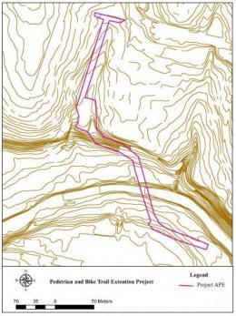
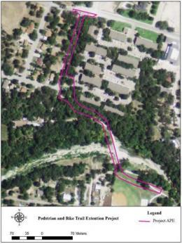
GIS
Review agencies require cultural resource mapping data in the form of shapefiles from qualified professionals that meet the Secretary of the Interior’s Standards and Guidelines for Archaeology and Historic Preservation. We use WAAS enabled and sub meter accurate Global Positioning Satellite (GPS) systems to record and collect mapping data for our clients’ projects. This information is imported into a geographic information system (GIS). Utilizing a GIS data management systems allows us to capture, store, manipulate, analyze, organize, and present geographical data during all phases of agency review. On smaller and larger Linear-Type or Area-Type projects, our GIS mapping methodology fulfills review agency submission requirements that document high probability areas where cultural resources are likely to be present within our client's Project direct and indirect Area of Potential Effects. Our Company prepares GIS maps that are clear, concise, and approved by review agencies.
- GPS Surveys and Field Data Acquisition
- Spacial Analysis of Field Data
- Archaeological and Historic Graphics
- Georeferencing Historic Maps
"The historic overlay work will be an excellent reference for this area in the future - a useful tool. It is fascinating to see the changes through time!"
USACE Galveston District